skip to main |
skip to sidebar
Svastikor vi minns: Swastika, Texas
Swastika, perhaps due to the name's association with the Nazis, has been removed from even the most detailed county maps. It first appeared on the General Land Office 1920s map of Hale County and remained for both the 1930 Highway map and the 1940 state county map. It thereafter disappeared, with not so much as a cemetery shown for the town’s presence.
After the Nazis appropriated the Swastika for their political party, it fell out of favor. A history of the town may be available for a researcher in the Hale County area, but currently, there’s no content available for our coverage. Just the appearance on the old county maps.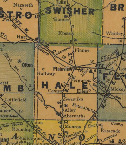
Swastika, Texas
Texas Ghost Town
Hale County, Texas Panhandle
I-27/ US 87
5 Miles S of Hale Center
18 Miles S of Plainview
About 8 Miles E of Cotton Center
Population: 0


Inga kommentarer:
Skicka en kommentar